

There are hiking trails. And then there is the Malerweg Trail.
Malerweg Trail Hiking Guide: Complete Autumn Hiking Adventure in Saxon Switzerland
I have walked paths across Europe, from the highlands of Scotland to the limestone karst of Slovenia, and I can tell you with a straight face that this 116-kilometre loop through Germany’s Saxon Switzerland belongs in a completely different conversation. The sandstone towers rising out of dense forest. The mist drifting through narrow gorges at dawn. The moment you cross the Bastei Bridge and suddenly understand why 19th-century Romantic painters couldn’t stop coming back here.
This Malerweg Trail hiking guide covers everything you need to plan a complete, rewarding multi-day hike — all eight stages, the best time to go (spoiler: autumn), gear you’ll actually use, accommodation options, and a practical day-by-day itinerary. Whether you’re lacing up your boots for the first time on a long-distance trail or already have a few hundred kilometres behind you, this guide has you covered.
Let’s get into it.
What the Malerweg Trail Is and Why It Is Famous
The History Behind Germany’s Painter’s Trail
The name says it all. Malerweg translates directly to “Painter’s Path” in German, and the trail owes its name to the wave of Romantic-era artists who flooded into Saxon Switzerland throughout the 18th and 19th centuries in search of wild, dramatic scenery to paint. Caspar David Friedrich, the most celebrated of them all, repeatedly walked these sandstone ridges and turned the brooding landscapes into some of the most iconic paintings in German art history.
Two Swiss artists — Adrian Zingg and Anton Graff — are often credited with coining the name “Saxon Switzerland” after studying at the Dresden Art Academy in 1766. They saw the sandstone formations rising east of the city and were immediately reminded of their homeland. The name stuck. And so did the artistic pilgrimage.
Location Within Saxon Switzerland National Park
Geographically speaking, the Malerweg sits inside the Elbe Sandstone Mountains, about 30 kilometres southeast of Dresden in the German state of Saxony. The trail loops through Saxon Switzerland National Park, which covers nearly 100 square kilometres of protected landscape and shares a border with the Bohemian Switzerland National Park across the Czech Republic.
Access is genuinely easy. Dresden has excellent rail connections across Europe, and from there you’re looking at 30 to 40 minutes by S-Bahn to reach Pirna, the trail’s main gateway town.
Unique Landscapes That Define the Route
Saxon Switzerland looks like nothing else in Germany. Forget the Black Forest or the rolling green hills of Bavaria. The Elbe Sandstone Mountains are something wilder — spires and mesas of ancient sandstone rising sharply out of dense forest, carved by millions of years of wind and water into formations that look almost architectural. Deep, shaded gorges cut between rock walls. The Elbe River winds through the valley below, and on clear autumn mornings the whole thing looks like it was lifted from a Romantic painting. Which, of course, it was.
Why the Trail Attracts International Hikers
It has been voted Germany’s most beautiful hiking trail by hikers — more than once. The combination of accessible difficulty, well-marked paths, excellent infrastructure, and genuinely extraordinary scenery makes it magnetic for hikers from across Europe and beyond. Unlike some long-distance trails where you spend days in unremarkable countryside between the highlights, the Malerweg delivers consistently. Nearly every stage has something worth stopping for.
Malerweg Trail at a Glance
Total Distance and Duration
The Malerweg covers 116 kilometres (72 miles) in a loop that starts and ends in the Liebethal district of Pirna. The official recommendation is to split it into eight daily stages, which works out to an average of roughly 14.5 kilometres per day. That sounds gentle on paper. The terrain will remind you it is not.
Trail Difficulty and Elevation Gain
Be honest with yourself about this one. The total elevation gain over the full route sits at approximately 3,500 to 4,500 metres. Some stages involve ladders, metal staircases, and narrow rock passages that require a reasonable head for heights. The trail is rated moderate to challenging. It’s not technical mountaineering, but it is not a Sunday stroll either. First-time multi-day hikers can absolutely do it — just don’t underestimate the cumulative effort of sustained ascent and descent every day.
Starting and Ending Points
The trail starts and ends in Liebethal, a district of Pirna. Most hikers complete the loop counter-clockwise — Pirna to Liebethal — following the official stage numbering. This direction progresses from easier stages to harder ones, which most hikers (including me) prefer. You warm up before the real climbing begins.
Trail Markings and Navigation
The Malerweg is excellently signposted throughout. Look for the distinctive green diamond with an artist’s palette symbol on trail markers. The path is also accessible via public transport at almost every stage endpoint, which gives you useful flexibility if plans change or legs give out.
Recommended Direction of Travel
Counter-clockwise. Stage 1 is the gentlest introduction and Stage 4 — with the Schrammsteine — is the most demanding. Going counter-clockwise means you work your way into the harder terrain gradually rather than being thrown into the deep end on day one.
Quick-Reference Trail Summary
| Detail | Info |
|---|---|
| Total Distance | 116 km (72 miles) |
| Official Stages | 8 |
| Total Elevation Gain | ~3,500–4,500 m |
| Difficulty | Moderate to Challenging |
| Best Season | April–October (autumn peak: late Sept–Oct) |
| Accommodation | Available in every stage village |
| Start / End Point | Liebethal / Pirna (loop) |
| Trail Marking | Green diamond with painter’s palette |
Why Autumn Is the Best Time to Hike the Malerweg Trail
Peak Fall Foliage Along the Route
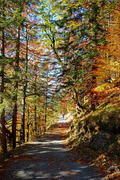
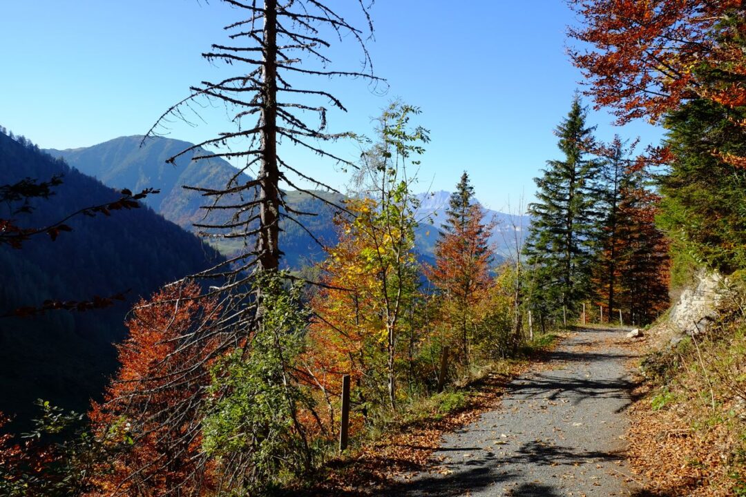
There is literally no better season to admire the beauty of Saxon Switzerland than autumn. I’ve hiked sections of this trail in summer and come back specifically in October to do the full route, and the difference is extraordinary. The dense forest canopy that covers much of the trail turns through shades of amber, copper, and deep red. The sandstone formations — already dramatic — glow warm gold in the low autumn light. Every valley section becomes a tunnel of colour. Every ridgeline view opens up over a sea of russet forest.
Comfortable Hiking Temperatures
Summer on the Malerweg can be punishing. The trail runs through enclosed gorges and exposed ridge sections, and on a hot July afternoon the climbing stages are genuinely brutal. Autumn brings temperatures that are simply more pleasant for sustained physical effort — typically between 8°C and 18°C across September and October, cool enough to hike hard without overheating, warm enough to enjoy the viewpoints without immediately reaching for every layer you own.
Reduced Crowds Compared to Summer
Here’s the honest truth about the Bastei in July: it’s a zoo. One of the most recognisable viewpoints in Germany, packed with day-trippers, tour buses, and every kind of camera. In autumn, particularly on weekdays, the same viewpoint becomes something closer to the atmospheric scene the Romantic painters actually experienced. The trail overall thins out significantly from mid-September onward. You’ll see other hikers — this is still a popular trail — but you won’t be hiking in a convoy.
Photography Opportunities During Autumn
Low golden light. Mist in the gorges at dawn. Fiery forest canopy against grey sandstone. Autumn on the Malerweg is genuinely one of the most photogenic conditions you can find on any European hiking trail. If you care even slightly about trail photography, plan your trip for October and do not skip early morning starts.
Best Time to Visit During the Autumn Season
Early Autumn Conditions
September is a transitional month. Summer crowds are thinning, temperatures are dropping into a comfortable range, and the forest is just beginning to turn. The colour change typically starts at higher elevations in mid-September and spreads downward. Accommodation is generally available without advance booking stress, though I’d still recommend booking ahead for popular guesthouses.
Mid-Autumn Color Peak
October is the sweet spot. This is when the foliage peaks across most of the route — typically between early and mid-October in Saxon Switzerland. Temperatures can vary widely; warm sunny days alternate with cooler, misty mornings. Rain is possible but rarely sustained. This is, in my opinion, the single best month to hike the Malerweg. Book accommodation at least four to six weeks out for the best options.
Late Autumn Hiking Experience
November is doable but requires awareness. Many guesthouses, mountain huts, and restaurants along the trail begin closing for winter from early November onward. Low season officially starts in Saxon Switzerland around the first days of November, and accommodation becomes genuinely difficult on certain stages. Day length also shortens considerably. If you’re determined to hike in November, research accommodation availability stage by stage before committing.
Typical Weather and Trail Conditions
| Month | Avg Temp (Day) | Crowds | Foliage | Accommodation |
|---|---|---|---|---|
| September | 13–18°C | Moderate | Starting to turn | Widely available |
| October | 8–14°C | Low–Moderate | Peak colour | Book in advance |
| November | 3–8°C | Very Low | Late/bare | Limited — plan carefully |
Complete Malerweg Trail Stage-by-Stage Breakdown
Here’s where it gets practical. Each stage below includes distance, time, highlights, difficulty, and accommodation notes. Use this as your planning backbone.
Stage 1 – Pirna to Liebethal
Distance: ~13 km | Time: 4–5 hours | Difficulty: Easy
The gentlest introduction to the trail. You begin in the historic centre of Pirna — worth spending an hour in before you set off — and follow the Malerweg through forest paths and past the Richard Wagner monument. The Mill Promenade section along the Wesenitz stream is particularly pleasant. The stage ends beautifully with views over the Elbe valley toward Stadt Wehlen. A solid warm-up day.
Highlights: Pirna’s historic old town, Wesenitz valley, Felsentor rock arch, first sandstone formations.
Accommodation: Guesthouses available in both Liebethal and Stadt Wehlen.
Stage 2 – Liebethal to Stadt Wehlen
Distance: ~15 km | Time: 5–6 hours | Difficulty: Easy–Moderate
This stage follows the Polenztal valley and climbs through rock formations before delivering you to one of the most dramatic moments on the entire trail: your first view of the Bastei rock complex from above. The descent into Stadt Wehlen via the Schwarzbergweg is memorable. But here is the catch — the section approaching the Bastei gets very busy in summer. In October, it’s a completely different atmosphere.
Highlights: Polenztal valley, Bastei approach views, Stadt Wehlen on the Elbe.
Accommodation: Several guesthouses and hotels in Stadt Wehlen.
Stage 3 – Stadt Wehlen to Hohnstein
Distance: ~14 km | Time: 5–6 hours | Difficulty: Moderate
The Bastei stage. This is the one everyone photographs. You cross the famous Bastei Bridge over a chasm of sandstone pillars, take in views over the Elbe valley that will make you stand there longer than you planned, and then continue through varied forest and plateau terrain to Hohnstein. The Bastei itself is one of the most visited landmarks in Germany — arrive early to beat the day-trippers. Before 8am in October? Near-magical.
Highlights: Bastei Bridge, Bastei rock formations, Hohnstein Castle perched above the valley.
Accommodation: Hohnstein has a well-known hostel (Burg Hohnstein) and several guesthouses.
Stage 4 – Hohnstein to Altendorf
Distance: ~18 km | Time: 6–7 hours | Difficulty: Moderate
A longer, more varied stage that crosses the “balcony of Saxon Switzerland” with panoramic views before descending steeply into deep valleys. The Brandbaude viewpoint is a legitimate jaw-dropper — eating lunch up there on a clear autumn day is one of those hiking moments you remember for years. The descent involves roughly 800 steps. Your knees will know about it. Pack trekking poles.
Highlights: Brandbaude panoramic viewpoint, Hockstein rock, Polenztal valley, Tiefen Grund.
Accommodation: Limited in Altendorf itself; Kirnitzschtal valley has guesthouses.
Stage 5 – Altendorf to Neumannmühle
Distance: ~19 km | Time: 6–7 hours | Difficulty: Hard
The hardest stage on the trail. The Schrammsteine ridge is the undisputed highlight of the entire Malerweg — a dramatic sandstone ridge with a traverse that involves ladders, narrow passages, and sections requiring genuine sure-footedness. The elevation gain on this stage is roughly 740 metres. It is genuinely demanding. It is also genuinely spectacular. The Kuhstall natural arch and the “Ladder to Heaven” (Himmelsleiter) are experiences you won’t forget. Wet weather makes this stage significantly more difficult; check forecasts carefully.
Highlights: Schrammsteine ridge traverse, Kuhstall natural arch, Himmelsleiter ladder climb, Lichtenhain Waterfall.
Accommodation: Neumannmühle has a historic inn directly on the trail.
Stage 6 – Neumannmühle to Schmilka
Distance: ~18 km | Time: 6–7 hours | Difficulty: Moderate–Hard
This stage climbs to the Großer Winterberg, the second-highest point in Saxon Switzerland at 556 metres, and then descends into the village of Schmilka on the Elbe — right on the Czech border. The views from the summit on a clear autumn day extend far into Bohemian Switzerland. The Goldstein viewpoint mid-stage is worth the short detour. Schmilka is a charming base for the night, with a historic inn and organic brewery.
Highlights: Großer Winterberg summit, Goldstein viewpoint, Schmilka village, Elbe crossing.
Accommodation: Bio-Hotel Helvetia in Schmilka is excellent and popular — book ahead.
Stage 7 – Schmilka to Gohrisch
Distance: ~18 km | Time: 6–7 hours | Difficulty: Moderate
A stage of contrasts. The ferry crossing at the start sets the mood perfectly — there’s something deeply satisfying about beginning a hiking day on a river ferry. The trail climbs steeply to the plateau, passes the striking Kaiserkrone, and winds through sandstone formations with views over the Elbe valley. The Pfaffenstein detour is absolutely worth the extra steps. Papststein, with its observation tower and mountain inn, is a great late-afternoon stop before the final descent into Gohrisch.
Highlights: Elbe ferry crossing, Kaiserkrone, Pfaffenstein with Barbarine formation, Papststein viewpoint.
Accommodation: Several guesthouses in Gohrisch and surrounding villages.
Stage 8 – Gohrisch to Weißig (Pirna)
Distance: ~11 km | Time: 3–4 hours | Difficulty: Easy–Moderate
The closing stage. Appropriately, it brings you back through forest and plateau landscapes to the Robert-Sterl-Haus art museum — the most important art museum in Saxon Switzerland, fittingly dedicated to a painter who lived and worked in this region. From there the trail follows the old Lohmstraße and high banks of former stone quarries to the historic centre of Pirna. A satisfying, reflective end to a trail that thoroughly earns its reputation.
Highlights: Robert-Sterl-Haus, Königsnase viewpoint, return to Pirna historic centre.
Accommodation: Full range of hotels in Pirna.
Stage-by-Stage Summary Table
| Stage | Route | Distance | Time | Difficulty | Key Highlight |
|---|---|---|---|---|---|
| 1 | Pirna → Liebethal | ~13 km | 4–5 hrs | Easy | Felsentor, Wesenitz valley |
| 2 | Liebethal → Stadt Wehlen | ~15 km | 5–6 hrs | Easy–Moderate | Bastei approach |
| 3 | Stadt Wehlen → Hohnstein | ~14 km | 5–6 hrs | Moderate | Bastei Bridge |
| 4 | Hohnstein → Altendorf | ~18 km | 6–7 hrs | Moderate | Brandbaude viewpoint |
| 5 | Altendorf → Neumannmühle | ~19 km | 6–7 hrs | Hard | Schrammsteine, Kuhstall |
| 6 | Neumannmühle → Schmilka | ~18 km | 6–7 hrs | Moderate–Hard | Großer Winterberg |
| 7 | Schmilka → Gohrisch | ~18 km | 6–7 hrs | Moderate | Pfaffenstein, Kaiserkrone |
| 8 | Gohrisch → Pirna | ~11 km | 3–4 hrs | Easy–Moderate | Robert-Sterl-Haus, Pirna |
Iconic Landmarks Along the Malerweg Trail
Bastei Bridge and Rock Formations
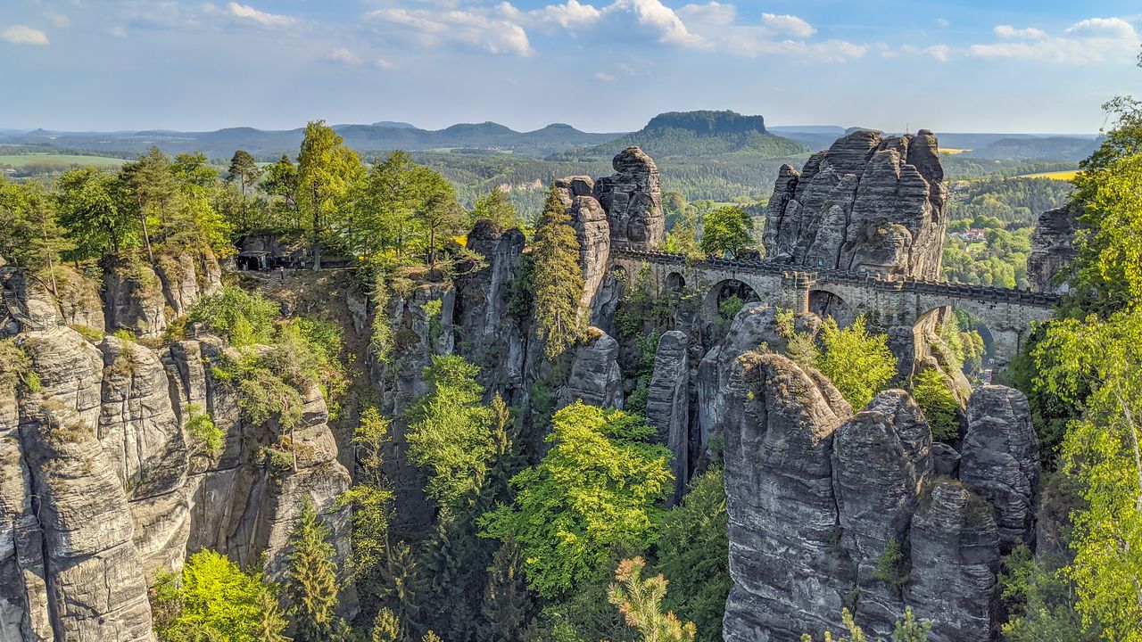
You cannot hike the Malerweg without talking about the Bastei. This series of sandstone pillars rising 194 metres above the Elbe — connected by a dramatic stone bridge — is one of the most photographed landscapes in Germany. It’s busy. It’s worth it. The trick is timing: arrive before 8am or after 5pm to experience it without the crowds. In autumn mist, from the bridge, looking down at the river valley below? Absolutely unreal.
Schrammsteine Ridge
The Schrammsteine is a long, narrow sandstone ridge that the trail traverses via a series of ladders, handholds, and narrow passages. It’s the most technically demanding section of the Malerweg and also one of the most exhilarating. The 360-degree views from the ridge top extend across Saxon Switzerland into Bohemia. Take it slowly. Check the weather. Do not attempt this section in rain if you’re not experienced on exposed terrain.
Lilienstein Mountain
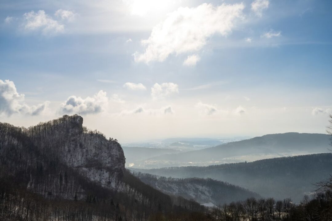
This flat-topped mesa is one of the most distinctive formations in the Elbe Sandstone Mountains. It rises steeply from the valley floor with sheer walls on all sides, visible from much of the trail as a defining landmark. The ascent from the valley offers excellent views across to Königstein Fortress.
Kuhstall Natural Arch
One of the largest natural rock arches in Saxony, the Kuhstall (Cow Shed) is a massive cave-like opening in the sandstone used historically as a shelter during wars. You walk directly through it on Stage 5, emerging on the far side to a viewpoint that makes the effort of climbing here completely worthwhile.
Fortress Königstein
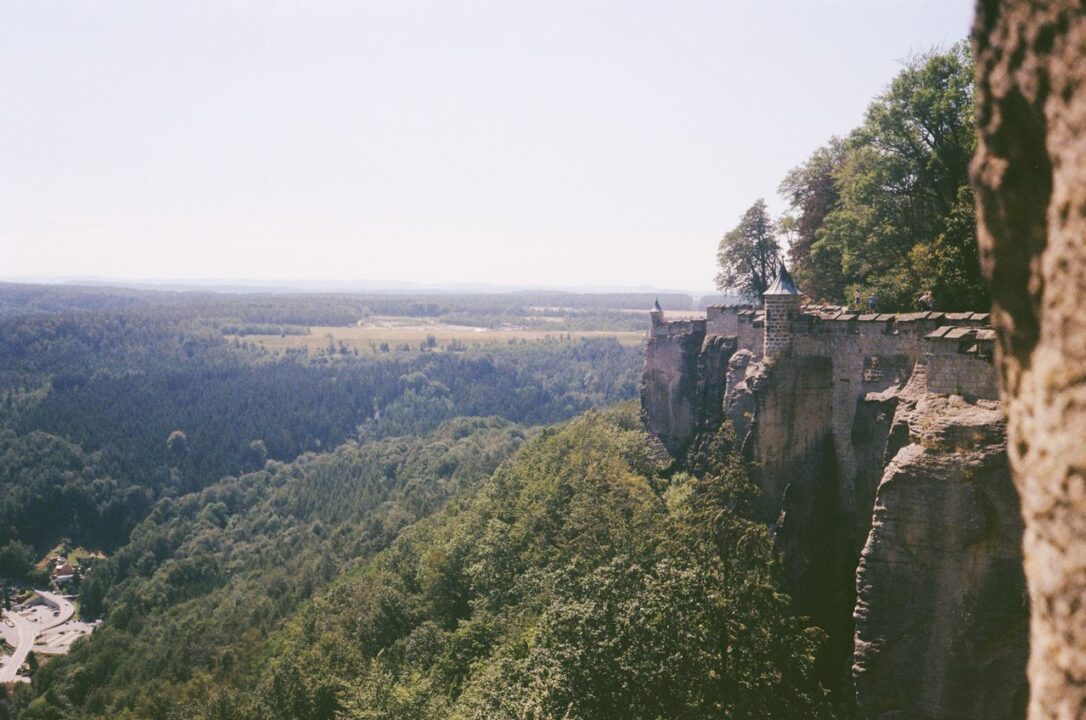
Arguably the most historically significant landmark on the entire route. Königstein Fortress sits atop a 247-metre mesa above the Elbe and has never been conquered in its entire history. It’s often described as one of the largest hilltop fortresses in Europe. There’s an entrance fee to visit the interior — around €12–15 for adults — and I genuinely think it’s worth at least an hour or two if your schedule allows.
Romantic Elbe Valley Views
The Elbe River runs through the heart of Saxon Switzerland and provides context to the entire trail. From multiple ridge viewpoints along the Malerweg you look down at its silver loops between forested hills and sandstone cliffs. These are the views that drove Romantic painters to fill sketchbooks. In autumn, the valley glows.
Planning Your Autumn Malerweg Hiking Trip
How to Reach the Trailhead
Dresden is your gateway. The city has a major international airport (Dresden Airport, DRS) with connections to several European hubs, and excellent rail connections from Frankfurt, Berlin, Prague, and beyond. From Dresden Hauptbahnhof, the S1 S-Bahn line runs directly to Pirna in approximately 30 minutes. From Pirna, Liebethal is a short local bus or taxi ride.
If you’re driving, there’s a free car park near the Liebethal trailhead at approximately 50.9967°N, 13.9563°E. Since the trail is a loop ending in Pirna rather than directly at the car park, you’ll need to catch a bus back — about 45 minutes from Pirna to Liebethal.
Transportation Within Saxon Switzerland
One of the Malerweg’s real practical advantages is its public transport connectivity. Almost every stage endpoint is accessible via the S-Bahn network or local buses. The historic Kirnitzschtal tram — a charming narrow-gauge electric tramway — runs along the valley on Stage 5. This connectivity means you can start any stage by train or bus, or exit the trail at any point if needed.
Booking Accommodation During Autumn
Book early for October. Autumn is popular and the accommodation options along some stages — particularly Neumannmühle, Schmilka, and Altendorf — are limited in number. I recommend booking the full route at least four to six weeks ahead for an October trip. September is more forgiving, but still worth booking in advance for the better guesthouses.
Suggested Number of Hiking Days
Eight days is the official recommendation and, honestly, it’s the right call for most hikers. Going faster compresses your time at the best viewpoints and makes the harder stages feel more like punishment than adventure. If you’re very fit and have done multi-day hikes before, six days is achievable. Five is possible but leaves little room for bad weather days or spontaneous detours. Going slower — 10 days — is a genuinely lovely way to hike it.
Budget Expectations
The Malerweg is very accessible financially. One hiker completed the full 8-day route for approximately €336 total, with accommodation running around €170 for the whole trip at family-run guesthouses and budget options. Add food (€20–35 per day at guesthouses and trail restaurants), transport to and from Dresden, and entrance fees (Königstein Fortress is the main one), and you’re looking at roughly €500–700 for a full eight-day self-guided trip — less if you’re careful, more if you prefer comfortable hotels.
Essential Gear for Hiking the Malerweg Trail in Autumn
Clothing Layers for Variable Weather
Autumn weather in Saxon Switzerland is genuinely variable. You can start a day in October under clear blue skies and finish it in driving rain with temperatures that have dropped 8 degrees. The classic layering system applies: a moisture-wicking base layer, a mid-layer fleece or down jacket, and a waterproof shell that actually works. Don’t cheap out on the waterproof — some gorge sections and ridge traverses are completely exposed.
Recommended Footwear
This is not the trail for trail runners or lightweight hiking shoes. The Schrammsteine traverse, the ladder sections, and multiple steep rock descents require ankle support and a proper grip sole. Waterproof mid-cut hiking boots are what you want. Break them in before you arrive — blistered feet on day two of eight is genuinely miserable.
Navigation Tools and Apps
The trail is well-marked enough that most hikers won’t need complex navigation tools. That said, I always recommend downloading the GPX track to a watch or phone app (Komoot and AllTrails both have the full Malerweg with all stages). Signal can be patchy in the deeper gorge sections. Offline maps are your friend.
Photography Equipment
For autumn photography specifically: bring a wide-angle lens for the sweeping valley shots from the Bastei and Schrammsteine, a standard zoom for forest detail and colour, and a polarising filter for cutting through mist and enhancing the autumn tones. The light is best in the first and last two hours of the day — plan your position accordingly.
Safety and Emergency Essentials
A basic first aid kit, an emergency whistle, and a fully charged phone should be non-negotiable. Trekking poles are genuinely useful on the descent-heavy stages (3, 5, and 6 especially). Headlamp for early starts or late finishes. And for goodness’ sake, carry a dry bag for your electronics and spare clothing — autumn rain is not theatrical, it’s wet.
Autumn Gear Checklist
| Category | Item | Essential? |
|---|---|---|
| Footwear | Waterproof mid-cut hiking boots | Yes |
| Footwear | Camp shoes / sandals for evenings | Recommended |
| Clothing | Moisture-wicking base layer | Yes |
| Clothing | Fleece or down mid-layer | Yes |
| Clothing | Waterproof shell jacket | Yes |
| Clothing | Waterproof trousers | Yes |
| Clothing | Warm hat and gloves | Yes (October/Nov) |
| Gear | Trekking poles | Strongly recommended |
| Gear | Headlamp with spare batteries | Yes |
| Gear | Navigation app with offline GPX | Yes |
| Safety | Basic first aid kit | Yes |
| Safety | Emergency whistle | Yes |
| Hydration | 2-litre water capacity minimum | Yes |
| Pack | Dry bags for electronics | Yes |
Accommodation Options Along the Route
Traditional Guesthouses
The backbone of Malerweg accommodation. Family-run Gasthöfe and Pensionen are scattered throughout every stage village. These are typically simple, clean, and unpretentious — double rooms, hearty dinner in the in-house restaurant, and a packed lunch you can arrange the evening before. They’re also usually the cheapest option and often the most characterful. Expect to pay €40–70 per person per night including dinner in many cases.
Mountain Inns and Refuges
Several trail-specific inns sit directly on or very close to the Malerweg, including the historic Neumannmühle and the beloved Bergwirtschaft Papststein on Stage 7. These fill up fast in autumn. Book them the moment you fix your dates.
Budget-Friendly Lodging
Burg Hohnstein — a youth hostel inside a castle — is one of the best-value sleeps on the entire trail. Genuinely atmospheric, well-equipped, and perfectly placed at the end of Stage 3. Camping is an option outside the national park’s core zone, and “Boofen” — sleeping legally under rock overhangs — is a culturally significant tradition in Saxon Switzerland, though it requires prior permits in designated areas.
Comfortable Mid-Range Hotels
Pirna, Bad Schandau, and Königstein have proper hotel options if you want something more comfortable at either end of the trail. The Bio-Hotel Helvetia in Schmilka is genuinely lovely and organic — a real treat after Stage 6.
Booking Tips for Peak Autumn Weeks
Book the whole route before you leave home. Seriously. Accommodation on some stages — particularly Neumannmühle and Altendorf — is extremely limited. October sees the highest autumn demand. Leaving accommodation to chance on this trail is a plan that ends with you sleeping in Pirna and paying for a taxi to the next stage start. Plan ahead.
Food, Water and Resupply Information
Villages With Restaurants and Cafés
The Malerweg is well-served by trail restaurants and hut stops. Most stage villages have at least one restaurant or Gasthof serving hot meals. The key gaps are on Stage 5, where the first food stop after the trailhead can be 15 kilometres in — pack enough snacks to cover a full morning on that stage.
Water Refill Opportunities
Don’t rely on natural water sources. In villages and at guesthouses, water is freely available. On trail, natural water is rarely safe to drink without treatment. Carry at least 2 litres out of each accommodation stop, particularly for the longer stages (4, 5, 6, and 7).
Local Saxon Dishes Worth Trying
You are in Saxony — embrace it. Saxon cuisine is hearty, warming, and exactly what hiking legs want at the end of a long day. Look for Sauerbraten (marinated pot roast), Quarkkeulchen (cottage cheese pancakes), Zwiebelrostbraten (roast beef with onions), and regional beers. The organic brewery in Schmilka makes an excellent pale ale that tastes considerably better after a 19-kilometre day.
Packing Snacks for Longer Stages
Trail mix, energy bars, and chocolate are standard. On Stage 5 especially — the longest and hardest stage — pack enough to sustain six or seven hours of demanding hiking without relying on finding an open food stop mid-route.
Trail Safety and Hiking Regulations
National Park Rules
This is a protected national park — act accordingly. Stay on marked trails at all times. Wild camping is illegal in the park’s core zone (Kernzone). Dogs must be kept on a leash throughout. Fires are prohibited. Leave No Trace principles apply in full. The park is patrolled, and rangers do check.
Wildlife Awareness During Autumn
Autumn is the rutting season for deer in Saxon Switzerland. You may hear and occasionally see deer in forest sections — keep your distance and don’t approach. The park also has wild boar populations that are more active in autumn as they forage before winter. Again: don’t approach, don’t feed.
Weather-Related Precautions
The Schrammsteine traverse is genuinely dangerous in wet conditions. The sandstone becomes slippery when wet, and the ladder and handrail sections on Stage 5 require confident footwork. If there has been sustained rain in the previous 24 hours, consider the optional lower path that avoids the most exposed sections. No view is worth an injury at that altitude.
Also be aware of standing deadwood and falling tree risk — particularly after storms. AllTrails and the official Malerweg website post trail closure notices regularly. Check before your stage departure.
Emergency Contacts and Rescue Information
The German emergency number is 112 for fire, medical emergency, and mountain rescue. The Sachsen Mountain Rescue can be reached directly at +49 3501 79070. Download an offline map so you can give your location even if data signal fails. Tell someone your route each morning.
Photography Guide to the Malerweg Trail in Autumn
Sunrise Viewpoints
The Bastei at dawn is in a different league from the same viewpoint at midday with 500 tourists. Set your alarm early on Stage 3 night — get up to the Bastei promontory before the light fully breaks and you’ll have the rock pillars, the mist, and the valley to yourself. Stage 7’s Papststein also offers exceptional east-facing views for sunrise.
Sunset Locations
The Großer Winterberg summit (Stage 6) gives west and northwest-facing views that catch afternoon and evening light beautifully. Stage 7’s Pfaffenstein also has a west-facing terrace that rewards a well-timed finish to the day’s hiking.
Best Forest Photography Spots
Stages 1, 4, and 8 take you through the most enclosed, atmospheric forest sections of the trail. In October, the beech and oak forest along the Wesenitz valley and in the deep sections of the Polenztal turn extraordinary shades of amber and red. These gorge sections catch mist beautifully in the morning — arrive at the right moment and the light coming through the canopy is soft and golden.
Capturing Autumn Colors Effectively
Shoot in the golden hour. Use a polarising filter to reduce glare and intensify colours in forest shots. For the wide valley views from the sandstone ridges, a graduated ND filter helps balance the bright sky with the darker valley below. In misty conditions, embrace it — mist in the gorges creates atmosphere that mid-day clear conditions can never match.
Comparing the Malerweg Trail With Other European Long-Distance Hikes
Malerweg vs West Highland Way
The West Highland Way (Scotland, 154 km) is longer but generally less technically demanding than the Malerweg. The Scottish trail has more exposed moorland, more variable weather, and less infrastructure mid-route. The Malerweg has better accommodation connectivity, more dramatic rock scenery, and higher technical sections. For first-time long-distance hikers, the Malerweg’s shorter stages and better support network make it slightly more accessible.
Malerweg vs Eagle Walk
Austria’s Eagle Walk is a significantly more demanding, higher-altitude Alpine route. The Malerweg is more accessible in terms of altitude (maximum around 556 metres) and doesn’t require Alpine experience. The Eagle Walk’s scenery is grander in scale; the Malerweg’s is more intimate and culturally layered.
Malerweg vs Tour du Mont Blanc
These two trails shouldn’t even be in the same conversation in terms of physical demand — the TMB is an elite Alpine circuit requiring high fitness and experience with altitude. The Malerweg is achievable for hikers of moderate fitness. But in terms of scenery quality and daily experience, the Malerweg absolutely holds its own against more famous European trails.
Comparison Table
| Trail | Distance | Max Altitude | Difficulty | Best For |
|---|---|---|---|---|
| Malerweg | 116 km | ~556 m | Moderate–Hard | First multi-day hikers, photographers, cultural interests |
| West Highland Way | 154 km | ~548 m | Moderate | Wild open landscape lovers, beginner-friendly |
| Eagle Walk | 413 km | ~2,800 m | Hard | Experienced Alpine hikers |
| Tour du Mont Blanc | 170 km | ~2,665 m | Very Hard | Strong, experienced mountain hikers |
Common Mistakes First-Time Malerweg Hikers Should Avoid
Underestimating Elevation Changes
This catches people out every single time. The daily distances look manageable — 14, 15, 18 kilometres. What new hikers don’t account for is the cumulative effect of 400–740 metres of ascent and descent every single day, repeated over eight days. By day four, legs that felt strong on day one are running on reserves. Build training hikes with significant elevation gain into your preparation before arriving.
Waiting Too Long to Book Accommodation
Already said it. Worth repeating. Some stage villages — Neumannmühle especially — have just a handful of beds available on the Malerweg. They fill up. Book early, or accept that you’ll have to plan alternative stages or add bus transfers.
Packing Excess Weight
Every kilogram on your back becomes two kilograms by Stage 5. Pack ruthlessly. A complete 8-day pack for the Malerweg — clothing, gear, safety kit, camera equipment — should sit between 7 and 12 kilograms for most hikers. Anything over that will compromise your enjoyment of the hardest stages significantly. If you’re uncertain about your pack weight, cut it in half and then add back only the items you absolutely cannot do without.
Ignoring Autumn Weather Forecasts
Saxon Switzerland weather in October can turn quickly. A morning that starts clear can deliver rain by noon. Check the forecast the night before each stage — particularly for Stage 5 where wet conditions on the Schrammsteine traverse are a genuine safety issue. The yr.no Norwegian weather service gives reliable forecasts for the region several days out.
Sample 5-Day Autumn Malerweg Itinerary
Can’t take eight days? Here’s a compressed version that covers the trail’s greatest hits, using public transport to bridge the gaps between the best sections.
Day 1 – Pirna to Hohnstein (Stages 1+2 combined)
Distance: ~28 km | Start early. A long first day, but both stages are relatively gentle and the terrain rewards the effort. Walk the Wesenitz valley, get your first views of the Bastei from above in the afternoon, and finish in Hohnstein in time for dinner at the castle hostel.
Day 2 – Hohnstein to Altendorf (Stage 3+4 highlights)
Distance: ~20 km. The Bastei at dawn — set that alarm. Cross the famous bridge in the morning light, continue through Stadt Wehlen, and push on to the Brandbaude viewpoint for a lunchtime spectacle before descending to Altendorf. This is a highlight-packed day.
Day 3 – Altendorf to Schmilka (Stages 5+6)
Distance: ~37 km — split this with the Kirnitzschtal tram if needed. The Schrammsteine traverse in the morning is the trail’s crown jewel. After the Kuhstall arch, take the valley tram to Lichtenhain Waterfall to join Stage 6 and climb to the Großer Winterberg. A challenging, deeply rewarding day. Stay in Schmilka.
Day 4 – Schmilka to Gohrisch (Stage 7)
Distance: ~18 km. Take the morning ferry and hike through the Kaiserkrone landscape. Detour to Pfaffenstein for the Barbarine formation. Rest at the Papststein summit inn before the descent to Gohrisch. A wonderful, scenically varied day.
Day 5 – Gohrisch to Pirna (Stage 8)
Distance: ~11 km. A gentle closing morning. Visit the Robert-Sterl-Haus, walk the forest paths, and return to Pirna for lunch. Spend the afternoon exploring Pirna’s historic old town before heading back to Dresden by S-Bahn.
Sustainable Hiking Practices in Saxon Switzerland
Leave No Trace Principles
This is a national park — every action matters. Pack out everything you pack in. Don’t pick plants or disturb wildlife. Stay on marked paths even when shortcuts look tempting; sandstone formations are surprisingly fragile and off-trail movement causes permanent damage.
Respecting Protected Landscapes
The sandstone formations that make the Malerweg spectacular took millions of years to form. They are also remarkably susceptible to erosion from repeated foot traffic off marked paths. Stick to the trail. Particularly on the Schrammsteine ridge and around the Bastei formations, every footstep off the path contributes to cumulative damage.
Supporting Local Communities
Buy local. Eat at the family guesthouses rather than packing in food from supermarkets in Dresden. These small businesses — many of them multigenerational — are the infrastructure that makes the Malerweg experience possible. The trail economy depends on hikers who spend money in the villages along the route. A meal at a local Gasthof does more for Saxon Switzerland than any sustainability pledge.
Final Thoughts on Hiking the Malerweg Trail in Autumn
The Malerweg Trail earned its reputation honestly. There’s no marketing trick here, no inflated expectation. It consistently delivers one of the most visually and physically rewarding multi-day hiking experiences available in Central Europe — and in autumn, when the forest catches fire with colour and the mist rolls through the gorges at dawn, it becomes something genuinely special.
I think what I love most about the Malerweg is how it refuses to let you go on autopilot. Every stage has something that demands your attention — a viewpoint that makes you stop mid-stride, a ridge traverse that requires your full focus, a valley section so quiet and green it feels like the world has receded. Eight days of that kind of hiking changes something in you. In a good way.
Plan it for October. Book accommodation early. Wear proper boots. Pack light. Start early each morning. Take every reasonable detour. And if the Bastei somehow looks too familiar from photos to feel surprising anymore — just wait until you’re standing on the bridge at 7am in October mist, looking down at the Elbe valley below, wondering how you lived without knowing this place existed.
Malerweg Trail Hiking Guide FAQs
How long does it take to hike the entire Malerweg Trail?
The official recommendation is eight days, split across eight stages ranging from 11 to 19 kilometres each. Fit hikers have completed it in six days, and some choose to extend to ten days to allow for rest days and more thorough exploration of side attractions.
Is the Malerweg Trail suitable for beginners?
It’s considered one of the better choices for first-time multi-day hikers due to its well-marked paths, excellent infrastructure, and stage-by-stage public transport access. However, “beginner-friendly” shouldn’t be confused with “easy” — the total elevation gain across eight days is substantial, and Stage 5 (Schrammsteine) is genuinely demanding with ladders and exposed terrain. Reasonable fitness and proper footwear are essential.
What is the best month to hike the Malerweg Trail in autumn?
October is the sweet spot for autumn hiking on the Malerweg. The foliage peaks across most of the route in early to mid-October, temperatures are comfortable for hiking, and crowds are significantly reduced compared to summer. Accommodation is still fully operational through October, whereas November sees many guesthouses and huts closing for winter.
Do I need to book accommodation in advance?
Yes — particularly for an October trip. Accommodation on some stages (Neumannmühle, Altendorf, Schmilka) is limited in quantity. Book the full route at least four to six weeks ahead for the best options. September is slightly more forgiving, but advance booking is still strongly recommended.
Can the Malerweg Trail be completed in fewer than eight days?
Yes. Five to six days is achievable for fit hikers, either by combining shorter stages or using the trail’s public transport connections to bridge sections. A five-day route focusing on the most scenic stages (3 through 7) is a practical option for those with limited time.
Is wild camping allowed along the Malerweg Trail?
Wild camping in the National Park’s core zone (Kernzone) is illegal. Outside the core zone, camping is technically possible but heavily monitored. Saxon Switzerland has a unique legal tradition called “Boofen” — sleeping overnight under designated rock overhangs — which is permitted in specific, signposted areas. This requires advance planning and is best researched through the official national park website.
What are the most scenic viewpoints on the route?
The Bastei rock formations and bridge (Stage 3), the Schrammsteine ridge (Stage 5), the Großer Winterberg summit (Stage 6), the Pfaffenstein with Barbarine formation (Stage 7), and the Brandbaude panoramic viewpoint (Stage 4) are consistently ranked as the route’s most spectacular visual highlights.
How difficult is the Malerweg Trail compared to other European hikes?
The Malerweg sits in the moderate-to-challenging range for European long-distance trails. It’s more demanding than the West Highland Way in terms of technical sections but far more accessible than Alpine routes like the Tour du Mont Blanc or Eagle Walk. The key challenge is cumulative elevation across eight days rather than extreme altitude or technical Alpine terrain.